Tools4MSP Geoplatform - legacy/deprecated version
Feb. 10, 2023, 11:25 a.m.
Newsletter 15 December 2016
ADRIPLAN: Planning the Sea

Tools4MSP
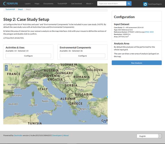
The Tools4MSP section in the ADRIPLAN Portal have been improved in usability and user experience including new scenario options for the COEXIST - sea use conflict analysis tool and Cumulative Impacts (CI) assessment tool for the Adriatic-Ionian Region: http://data.adriplan.eu/tools4msp/
Check out our new tutorial on how to use the Tools4MSP: http://data.adriplan.eu/documentation/tutorial/tools4msp/
NEW FEATURES
The ADRIPLAN PortalOur Portal has recently updated its About page. The page includes information on the functionalities of the ADRIPLAN Portal and the Tools4MSP, scientific and reporting documentation and of course a description of the TOOLS4MSP Team members.
Don't miss our video tutorials on how to use ADRIPLAN Portal!
A short user guideline to the ADRIPLAN Portal.
DATA UPDATES
Explore the newly updated datasets in the ADRIPLAN Portal:
- Mean significant wave height (Med-Scale)
- Mean superficial current speed (Adriatic-Scale)
- EUNIS Habitats (updated for September 2016)
RECENT AND UPCOMING EVENTS
Visiting Scientists at Center of Excellence for Environmental Decisions (CEED)Our team member PhD Chiara Venier and PhD Elena Gissi (IUAV, Venice) were visiting scientist at the Center of Excellence for Environmental Decisions (CEED) of the University of Queensland (Australia) under the Short Term Mobility Program of the Italian National Research Council (CNR). The three weeks experience aimed at supporting the decision making process on marine conservation, aquaculture and fishery in the Adriatic-Ionian Region through the application of Marxan, a decision support tool for planning scenario development and analysis.
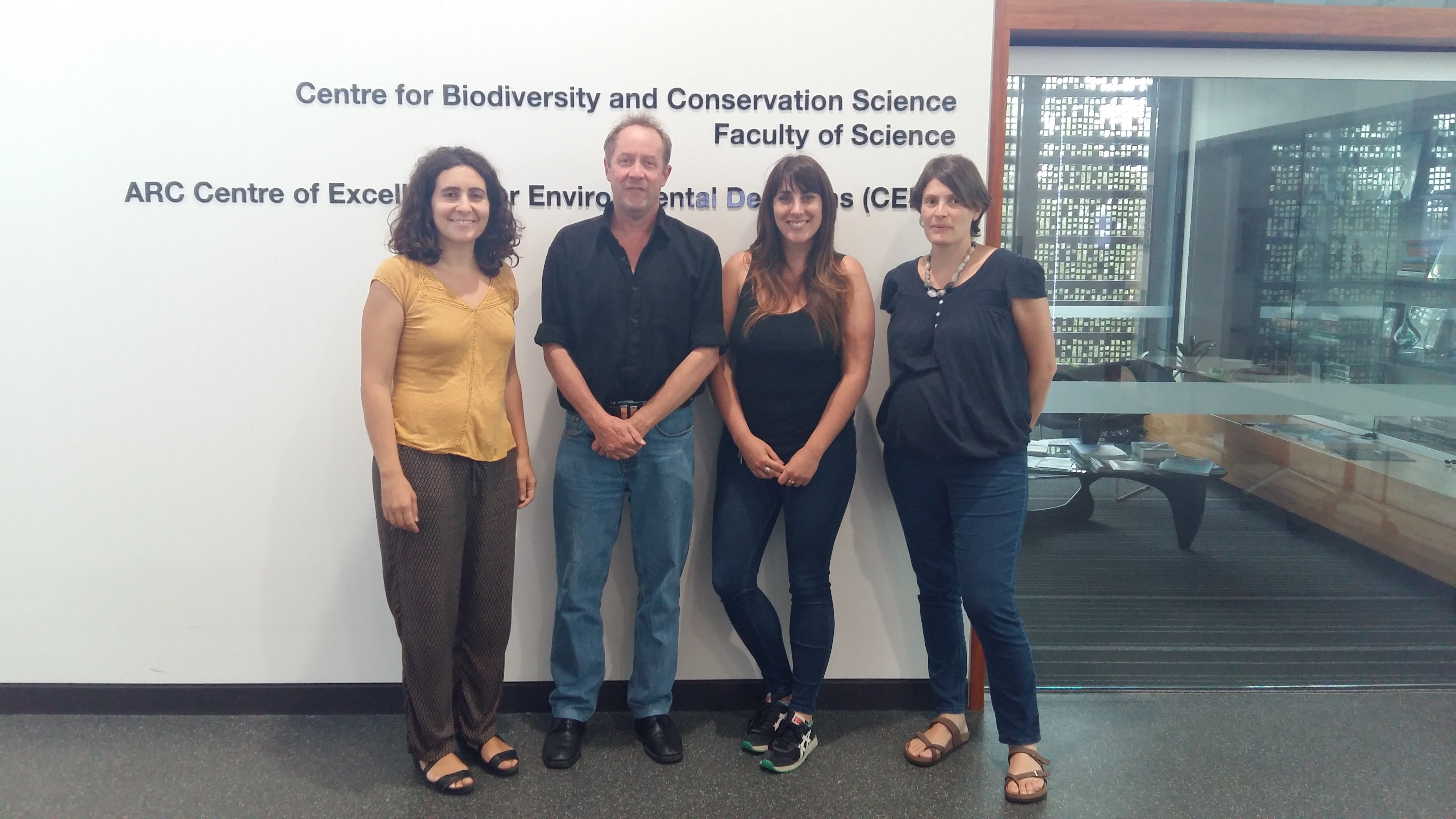
From left to right: Elena Gissi (IUAV), Prof. Hugh Possingham (CEED), Jennifer McGowan (CEED) and Chiara Venier (CNR-ISMAR).
Open Day "Aqua Granda" at CNR-ISMAR (29/10/2016)During the Open Day at CNR-ISMAR the Tools4MSP team was present with an information stand illustrating to young and adult visitors the importance and potentials of decision support systems based on open-source data for the Lagoon of Venice and the Adriatic-Ionian Region. The following systems have been presented
- SP7 - Spatial Data Infrastructure
- ADRIPLAN Portal
- CIGNO - ISMAR
- CIGNO - Environmental Atlas of the Lagoon
- Rete Meteo Marina
- ISMAR Data mobile APP
PROJECTS
Project Kickoffs:

MUSES Project (Multi-Use in European Seas, H2020),
Kick-off Meeting, 13-14 December, Brussels (Belgium).
Other project Kickoffs coming soon in 2017:
 MED-CO-EVOLVE (Promoting the co-evolution of human activities and natural systems for the development of sustainable coastal and maritime tourism, Interreg Med).
MED-CO-EVOLVE project aims at analyzing and promoting the co-evolution of human activities and natural systems in touristic coastal areas, allowing sustainable development of touristic activities based on the principles of ICZM/MSP. CO-EVOLVE couples a presently unavailable analysis at MED scale of threats and enabling factors for sustainable tourism with local studies on representative Pilot Areas, to demonstrate through pilot actions the feasibility and effectiveness of a ICZM/MSP-based planning process. More information coming soon.
 SUPREME(Supporting Implementation of Maritime Spatial Planning in the Eastern Mediterranean region, DG-Mare).
SUPREME project involves public authorities in charge of MSP, as designated by the Governs of four MS (GR, HR, IT and SL), and the UNEP/MAP Barcelona Convention. SUPREME will focus on two key objectives, stated in the call for proposals: 1. To supporting the implementation of Maritime Spatial Planning in EU Member States 2. To launch and carry out concrete and cross-border MSP initiative between Member States. More information coming soon.
SIMWESTMED(Supporting Implementation of Maritime Spatial Planning in the Western Mediterranean region, DG-Mare). SIMWESTMED will focus on supporting the implementation of the Directive on Maritime Spatial Planning in Member States' marine waters and launching and carrying out concrete, cross-border MSP cooperation between Member States in the Western Mediterranean region.
SP7 GET-It - Interoperable Infrastructure for the Observation Network and Marine Data
The sub-project SP7of the RITMARE aims to design an interoperable Spatial Data Infrastructure capable to manage data and information flows from different information systems in sub-projects of RITMARE without forcing the pre-existing practices already adopted by the RITMARE scientific communities. The Spatial Data Infrastructure can be accessed through the RITMARE Data Portal (v0.0) and allows user communties to access spatial data from one or multiple geographical areas in a common interface.
A new open source GET-It Starter Kit (Geoinformation Enabling ToolkIT starterkit) suite has been developed by researchers from IREA and ISMAR as a collaborative effort toward the integration of traditional geographic information with observational data. GET-it Starter Kit has helped various researchers to manage and make available their data in the RITMARE Data Portal.
REGISTRATION
You can register to our newsletter here.
You can register to the ADRIPLAN Portal here.
Registered users benefit from the ADRIPLAN Portal's full functionalities:
- Creation and download of customized maps.
- Run sea use scenarios on regional and macroregion level using Tools4MSP case studies.
Don't forget to follow us on twitter Tools4MSP@Twitter.
IMPRESSUM
The Newsletter is published by
Tools4MSP - Team
National Research Council -
Institute of Marine Sciences(CNR-ISMAR)
Arsenale - Tesa 104, Castello 2737/F,
30122 Venice, Italy
www.ismar.cnr.it
For more information: tools4msp[at]ismar.cnr.it
